The Empire raises its flag in London" read a headline in The Sunday Times on 14 December 2008, announcing a possible move by the British Empire and Commonwealth Museum from Bristol to London and highlighting the importance of understanding Britain's colonial past, "long a near-taboo subject for public discussion", as the accompanying article suggested.
The study of imperial history has, however, been on the scholarly agenda in recent years. Historians of cartography have been active in the debates, stimulated in part by Chicago's Newberry Library and its Hermon Dunlap Smith Centre for the History of Cartography, which hosts the occasional Nebenzahl Lectures in the History of Cartography. The 15th series of lectures was held in October 2004, and the centre's director, James Akerman, edited the papers to form the volume reviewed here.
Its subject is the connection between cartography and the exercise of imperial power. A series of Nebenzahl Lectures in 1985 analysed state-sponsored administrative and military cartography in Europe between 1400 and 1700. Over the following 20 years, interest in colonial and imperial cartography has burgeoned, and Akerman has had a rich field of scholars from whom to draw in seeking contributors to this volume.
His choices are excellent and his list of contributors impressive. Between them, they have looked at mapping in a range of cultures associated with the rise and maintenance of modern imperialism from the late 17th to the early 20th centuries. The essays all describe instances in which unequal power relationships between communities produced maps that represented imperial subjects for the exclusive benefit of the rulers. Together, the authors show that the picture of imperial mapping is complex, with religious doctrine, scientific exploration, commerce, ethnography, propaganda and administrative practice operating in different ways depending upon the context.
The first chapter, "The irony of imperial mapping" by Matthew Edney, attempts to define what is meant by "empire" and "imperial map". He compares maps by the French and British at home and overseas (in Egypt and India respectively) to show that there is little to differentiate between cartographic practices in states and empires. The critical distinction lies between the makers, subjects and users of the maps. In state mapping, there is a dialogue between those with a stake in what is being mapped, and a relationship is built up between the reader, territory and other inhabitants. By contrast, imperial maps were not made for the territory's inhabitants but rather for a remote audience. The inhabitants could then adopt similar styles of map and use them to serve anti-imperialist and nationalist movements.
While one way of expressing dominance was to conceal the presence of native peoples, Valerie Kivelson shows that this was not the practice in early imperial Russian mapping of Siberia, where religious ideology shaped both maps and territories. Unlike the English and Spanish colonists of the New World, Russian imperialism was not greatly concerned with the conversion of the conquered peoples to the Orthodox faith. It was too risky to antagonise native populations, from whom the tax revenues from fur provided the largest part of the tsar's income. Semen Remezov's atlases of Siberia from the late 17th and early 18th centuries pay scrupulous attention to the geography of ethnic and religious difference: land and people were indivisible.
Akerman asked Laura Hostetler to take the reader to China's Qing empire, and she argues convincingly that Qing success in extending and perpetuating its vast empire depended on its ability to communicate its claims internationally to rival powers and to the Chinese elite, and also on its use of indigenous maps to convey the shape and scope of the empire to its domestic audience. She shows how four maps based on Jesuit surveys differed from each other, how each was appropriate to its own context, was designed for a particular audience and served a different purpose. At the same time, each added strength to the imperial claim; together, they show the power of maps to normalise the image of empire and to absorb peripheral ethnic communities.
That there are limits to the ability of maps to master an empire is demonstrated by Neil Safier in his study of Portuguese mapping of its South American territories. While indigenous populations were kept off maps to remove the implication of a threat to authority, this does not mean that they were ignored. Safier analyses population maps of the Rio Negro to track statistical information about the local peoples. These "maps" look more like statistical tables, but they were conceived spatially and were designed to show information that could not be conveyed in a traditional cartographic format.
The relationship between scientific exploration and imperial mapping is examined by Graham Burnett in his study of the US Exploring Expedition of 1838-42, which had a mission of extending the "empire of commerce and science". He shows how there are similarities between the strict military discipline required of surveying parties to record and report hydrographic data, and the impact that discipline had on native populations. The power of maps was inseparable from the power of men, and this is demonstrated through a discussion of the trial of a hydrographic surveyor.
In the final chapter, Michael Heffernan looks at the ways in which imperial maps helped to strengthen popular perceptions of empire through British and French newspapers. Although technological advances had enabled newspapers to publish maps to accompany news stories, it was the outbreak of war rather than new printing technology that seemed to have determined map use. Newspaper maps from the 1870s to 1900 accentuated differences between distant parts of the empire and the settled regions of Europe; after 1900, maps emphasised actual and potential economic and commercial connections between European countries and their empires.
These are complex stories, but Akerman is to be congratulated on his editing. He has ensured that the reader is guided through case studies and well-constructed chapters that make good uses of summaries and conclusions.
In a book that relies heavily on visual material, the number and quality of illustrations is crucial. The University of Chicago Press is one of the major academic publishing houses producing books about the history of cartography, and it adopts very high standards. These are maintained in Akerman's volume, which is well put together. It would have helped, however, if there had been a note by the black-and-white (in fact rather grey-and-white, despite the quality of the paper) illustrations that are also reproduced in the colour plates, drawing this section to the reader's attention.
The Imperial Map provides a fascinating account of the relationship between mapping and the ways in which communities build and maintain empires. There is something here for all those interested in the political, social and imperial history and geography of past times. If the British Empire and Commonwealth Museum does indeed move to London, its curators would do well to read Akerman's book to help to put their collections into context.
THE EDITOR
James R. Akerman is director of the Hermon Dunlap Smith Centre for the History of Cartography at the Newberry Library, a position he has held for more than 20 years.
His research interests centre on the social and political aspects of cartography in Europe and the United States, particularly the history of atlases, educational cartography and transportation cartography.
Akerman has edited or co-edited a number of books, including Maps: Finding Our Place in the World, Chicago to Lake Geneva: A 100-Year Road Trip: Retracing the Route of H. Sargent Michaels' 1905 Photographic Guide for Motorists, The Mercator Atlas of Europe, Cartographies of Travel and Navigation and Two by Two: Twenty-two Pairs of Maps from the Newberry Library Illustrating 500 Years of Western Cartographic History.
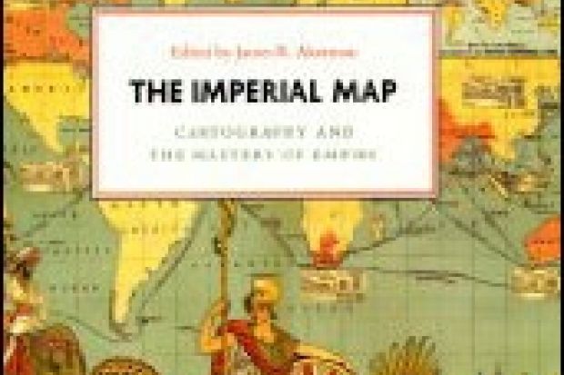
The Imperial Map: Cartography and the Mastery of Empire
Edited by James R. Akerman
University of Chicago Press 384pp, £41.50
ISBN 9780226010762
Published 13 April 2009
Register to continue
Why register?
- Registration is free and only takes a moment
- Once registered, you can read 3 articles a month
- Sign up for our newsletter
Subscribe
Or subscribe for unlimited access to:
- Unlimited access to news, views, insights & reviews
- Digital editions
- Digital access to THE’s university and college rankings analysis
Already registered or a current subscriber? Login